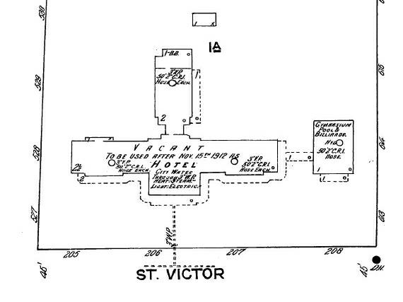
Sanborn maps are line drawings of sections of a town showing the streets and buildings in outline form. Because they were created for the use of fire insurance companies, they also show such things as fire wells, blacksmith shops, and anything that may be a fire hazard or useful to fight a fire. Although they are not so accurate as a professional survey, they do show the relative positions of the buildings as well as their outlines. For example, the Fenwick Sanitarium in 1912 had this outline:

The Vermilion Historical Society is pleased to make available to users of this website a number of Sanborn maps of towns in Vermilion Parish. Although other Vermilion Parish Sanborn maps exist, some are still protected by copyright. The maps offered here are in the public domain. The original maps were in color, but the colored ones are difficult to obtain, so these are in black and white.
The maps are in Adobe® Acrobat® PDF format, so it will be necessary to use the Adobe® Acrobat® Reader to open them. While you are viewing the maps with the Reader, you can zoom in on particular features. If you do not have the Adobe® Acrobat® Reader, you may download it free from the Adobe® website:
To download a map, simply click on the appropriate link below (after installing the Adobe® Acrobat® Reader if necessary). Your browser will open the file in the Adobe® Acrobat® Reader, where you can view the maps, print them, or save them to your hard disk. These downloads are free.
Downloads: